Landscape Analysis

Landscape Analysis - Key Characteristics
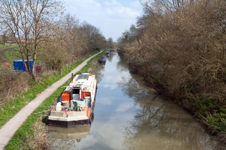
The canal is key landscape feature of the parish which provides a physical connection and means of movement between the villages. It is also a key tourist route with ‘honey pots’ around Sells Green and The Barge. The landscape beyond the villages is set within the valley and on the valley slopes; predominantly agricultural, with field boundaries predominantly marked by hedgerows; and interspersed with individual dwellings and farmsteads.
Roundway Hill and Salisbury Plain are key landmarks evident in views from the settlement edges.
Each of the villages have series of features which make them unique, as follows:
Seend [Link to maps and images]
- The settlement pattern lies along a major west to east ridgeline and forms a ribbon settlement along the A361. The village is identified in views from the south due to the individual large properties and church being clearly evident; conversely, views of the village from the north are limited to the rooftops of the northern-most dwellings and the community centre.
- The conservation area contains a number of historic buildings and a range of both deciduous and evergreen trees.
- The farmed valley slopes are visually open in views from the north, south and east.
- Larger properties with extensive grounds, often enclosed by walls, lie predominantly south of the A361 with commanding views over the vale to the south.
- Views out across the wider landscape are generally restricted due to the combination of dwellings and garden boundary enclosure. The Lye Field forms a central area of recreational open space and allows views out from the village, through the line of poplar trees, to the wider landscape to the north. This also brings a finger of green into the village.
- Community buildings are concentrated around The Lye Field.
- Clusters of trees are often associated with prominent buildings, such as the Church, large individual dwellings or at more exposed locations along the ridge.
- The horse pond at ‘three ways’ is an historic landscape feature, but due to the roadside wall, is not readily visible.
- A series of footpaths (some in green lanes, such as Love Lane) connect the village with the wider landscape and provides opportunities for a network of circular routes. Views from the perimeter footpaths are extensive over the surrounding valleys.
- Single track lanes north and south of the main road corridor.
- The settled village edges are broadly defined by the speed restriction signs. The Bell also marks the western edge of the village.
Seend Cleeve [Link to maps and images]
- Accessed predominantly by a narrow lane off the A361 Trowbridge Road which defines the southern edge of the village. Narrow lanes are a key feature of the village.
- Lies predominately on the north facing slopes of the major ridgeline, where dwellings form a skyline element in views from the north. The skyline is interspersed with occasional trees. The cluster of dwellings at ‘The Stocks’ straddles the A361 forming the southern edge of the village and evident in views from the south.
- The houses are close together with a more organic and compact settlement pattern.
- Dwellings on the west side of The Stocks lane have views over the vale towards Melksham.
- The Brewery pub is located more in the heart of the village.
- Is separated from Seend and Seend Head by a series of landscape gaps.
- Contains two former quarries, which are now designated as SSSI’s.
- A series of footpaths connect the village with the wider landscape and provides opportunities for a network of circular routes. Views from the perimeter footpaths are extensive over the surrounding valleys.
Sells Green [Link to maps and images]
- Predominantly a cluster of dwellings and business premises straddling the A365 and well related to the canal. The properties on the south side of the A365 have a more organic layout, with gardens backing on to Spout Lane.
- The camp site is key tourist destination, well contained in the valley landscape, due to the perimeter tree belts.
- The Three Magpies pub forms a key landmark building in views along the A365 from the east.
- The settlement pattern is clustered around the road corridors with parking again a combination of on and off street.
- Connectivity with Seend via the narrow Spout Lane and it’s hump back bridge over the canal.